When the Storm Prediction Center forecasts severe weather in their long range day 4 to day 8 outlook, it is probably a good idea to mark the dates down on your calendar and pay closer attention to weather forecasts. It is an indications of confidence in the forecast models for a severe weather event. We have two days being indicated in the long range outlook as of Tuesday 3/25/2025.
The first day of risk is Sunday 3/30/2025 into Monday morning 3/31/2025. The forecast is for a 15 percent chance or an implied slight risk for severe weather. Judgiing by the forecast dynamics in the atmosphere, and the strength of a developing stotm in the Mississippi River Valley this weekend, I would not be surprised to see an enhanced risk area or 30 percent chance added to this outlook in the coming days.
There is also severe weather risk indicated for Monday 3/31/2025 and this for the Middle and South Atlantic states from Virginia south to Georgia. The risk is 15 percent or implied slight risk for severe weather. We will likely also see elevated tornado risk on both days. All this is due to an active weather pattern that will develop across the US.
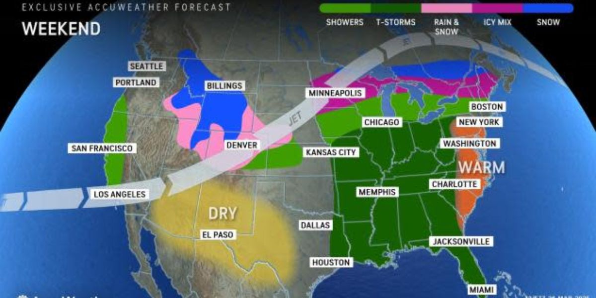
Weather models are supportive a strong outbreak of thunderstorms. Risks actually will begin to appear Saturday in the lower Mississippi Valley but for now the Storm Prediction Center is not indicating severe weather in their forecast at this time. There is enough uncertainty for them to wait until it gets into the short range time frame and that will happen this Thursday.
Low pressure is forecast to develop in the Middle Mississippi Valley Sunday and track to the Great Lakes Monday.
There will be a trailing north south cold front that will set off severe weather in the Mississippi River Valley, the Ohio & Tennessee Valleys and the Deep South Sunday and then it shifts to the East Coast Monday. We will be monitoring the weather situation carefully for the rest of the week and we will update the forecast as we get closer to the weekend.


