
Parts of the Arctic are currently experiencing unusually high temperatures, soaring 30 to 40 degrees above the average. This is primarily due to the presence of multiple intense heat domes. One of these heat domes has recently moved from northern Alaska to Canada’s Hudson Bay, resulting in several rounds of historically high temperatures. Meanwhile, another heat dome is causing similar conditions in parts of Scandinavia’s Arctic region, on the opposite side of the North Pole.
The extreme warmth in these areas is being amplified by human-induced climate change. This phenomenon is taking place in a region that has warmed three times faster than the global average. It also coincides with the National Oceanic and Atmospheric Administration’s (NOAA) recent announcement that July was the 14th consecutive month with record-high global temperatures.
Over the past week, temperatures have climbed to nearly 100 degrees Fahrenheit (37.8°C) in Norman Wells, Canada, which is located just 90 miles south of the Arctic Circle. Various locations in Alaska have also seen record-breaking highs, with the temperature reaching 90 degrees Fahrenheit (32.2°C) in Eagle, which is 193 miles east of Fairbanks. Off the coast of Greenland, Longyearbyen, Norway, known as the northernmost city on Earth with a significant population, recorded its warmest August day with temperatures approaching 70 degrees Fahrenheit (21.1°C).

As these high-latitude regions have warmed up, some of the cool air typically found there has been displaced into mid-latitude areas. This has provided temporary relief from the scorching summer heat in parts of the central and eastern United States.
In northern Canada, particularly under the heat dome, drought conditions have worsened, leading to widespread fires in many areas. Canadian weather historian Thierry Goose has documented an increasing number of temperature records. Some of the most notable records include:
- All-time highs in the Northwest Territories: Little Chicago at 97°F (36.3°C), Fort McPherson at 95°F (35.1°C), Inuvik at 95°F (34.8°C), Trail Valley at 92°F (33.6°C), and Paulatuk at 88°F (31°C).
- August record highs in the Northwest Territories: Fort Good Hope at 99°F (37°C), Norman Wells at 98°F (36.2°C), Tulita at 94°F (34.6°C), and Colville Lake at 87°F (30.4°C).
- August record highs in Nunavut (a region in far northern Canada): Arviat at 88°F (31.3°C), Chesterfield Inlet at 87°F (30.6°C), and Coral Harbour at 81°F (27.1°C). Arviat set monthly records on multiple days.
Similar records were set in Alaska due to the same heat dome before it moved eastward. For instance, Deadhorse, located along the southern coast of the Arctic Ocean, set an all-time high of 89°F on August 6, which was warmer than many places on Florida’s Peninsula.
On the opposite side of the globe, historic heat has also been recorded north of the Arctic Circle in Scandinavia in recent days. Longyearbyen, located in Norway’s Svalbard Islands, reached its highest August temperature on record on the 11th, with a high of 68°F (20.2°C). This was about 4 degrees Fahrenheit (2.2°C) above the previous monthly record, according to meteorologist Daan van den Broek. Remarkably, the next day, the temperature topped what was the previous record before 2024, marking an unprecedented occurrence of back-to-back highs.

On Monday, the European Union’s Copernicus Climate Service released images showing freshwater flowing into the ocean in the Svalbard Islands, stirring up sediment. The group noted that “[i]n early August, snow and ice melting on the surface of the Svalbard ice caps reached the highest levels ever recorded, while temperatures remained up to 5°C above average for this area of the Arctic Circle.”
This ongoing heat wave follows one of the hottest Julys on record for much of Canada, according to meteorologist Patrick Duplessis. Cities such as Edmonton and Calgary posted record highs in July. However, some places in far northern Canada that are currently experiencing record heat were colder than normal in July.
Also Read:
- Study Finds Andean Glaciers Shrinking Faster Than Ever Due to Rising Temperatures
- Record Temperatures Expected Across the Western U.S. as Heat Wave Intensifies
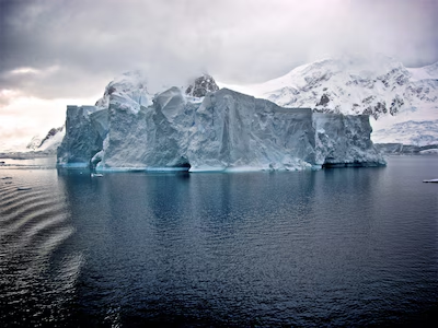
At the same time, Arctic sea ice levels are approaching their annual minimum and are currently the fourth lowest on record. This usual low point for the season typically occurs by mid- to late September. Forecasts indicate that temperatures in the Arctic and sub-Arctic regions of Canada will continue to run 10 to 20 degrees Fahrenheit (5.5 to 11.1°C) or more above normal for at least the next week to 10 days.